


On 18/09/2005 I and my classmates went on a trip to JOG Falls. We started at 6:00 am sharp towards the highest waterfalls of Asia which was 150 kms away from our source.

Early Morning 6:00 Am at Our Hostel Gate
The vehicle stopped at Bappanadu a small village after Mulki. For more information about this temple you can visit the following link: http://www.ourkarnataka.com/temples/bappanadutemple.htm. The driver dropped a coin at the temple beside the road, it is a tradition.
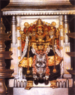
Bappanadu Temple Sri Durgaparameshwari
I would like to say one thing about Dakshina Karnataka (South Karnataka), its always green over here, green bushes every where. Even the walls are covered with grass or some other kind of creepers. Our first stop was at Aanegudde Vinayaka's Temple. For more information about this temple you can visit the following link: http://www.udupipages.com/home/temple/kumbashi.html.

Aanegudde Temple

At Aanegudde Temple I am Second from Right (Spotted)
Aanegudde means elephant hill, where we had our darshana so that the trip goes well. Next break was at Maravanthe beach, 50 kms from Udupi, is the sandy Maravanthe beach, this is the place where the sea is touching the road (parallel). At one side of the road we have sea, and on the other side we have a river, so if a Tsunami occurred by chance then you cannot escape.Its said that still now no damage has occurred to NH-17 across maravanthe beach. We had a nice time there. The road authorities placed some very huge rocks to restrict the sea from cutting away the road completely.
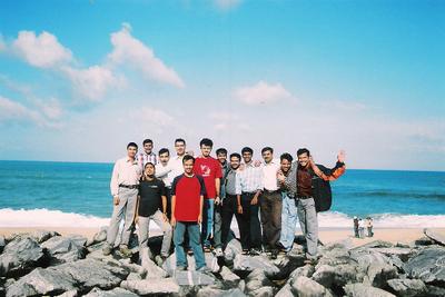

On the Rocks between NH-17 and Maravanthe beach


The endless stretch of golden sand, swaying palm trees, clear blue sky and the gush of the sea attracts a large number of tourists to this spot.The highway bordered on either side by the Arabian Sea and the Satuparnika River, with a backdrop of the Kodachadri Hills, makes the drive an out-of-the-world experience. At sunset, a crimson sky and golden rays reflected both in the sea and the river convert Maravanthe into a fairyland of scenic beauty.
Bushes converted into trees when we entered the western ghats, the ground started raising up from the sea level. I remember that western ghats started shortly after we have crossed a village called Bijur. This is one of my classmate's native place. He is very lucky to live in such a beautiful place.
Our next stop was at Murudeshwar. For more information about this temple you can visit the following link: http://www.karnatakatourism.com/coastal/murudesh/index.htm.
Here we visited lord Shiva temple. The mahagoopura of this temple is still under construction, but it is already around twenty floors. It looked like the temple almost pierced into the sky towards the heavens. That is not the end of this temple's specialty. The temple is surrounded by sea waters on all sides and it is connected to the land only by a road.


Mahagopura and Shiva Statue coming to equaility
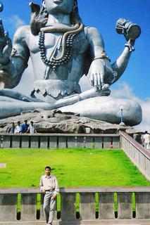
We walked around and went to see behind the temple, there sits an enormous statue of Lord Shiva, as if it were a competition to the mahagoopura at the front of the temple. If we want to have a comparison, the toe of that statue is a lot bigger than my face. It is like we have stood before the Vishrupa of Lord Shiva. We thought to stay there for some more time, but we are already late for Jog Falls. We started again.
One of my Friend Me
Huge Lord Shiva Statue
After a while we took diversion into NH-206 from NH-17 at Honnavara. Travelling on this road is a real adventure. It has a lots and lots of turns, U-turns, S-turns, Z-turns. Trees were now much denser than before as we reached our next stop which is at Sharavati river viewpoint. This means we have almost reached the actual place Jog Falls. It is still cold and the time is already 12:20. The road is now narrow and is much curvier; the forest is thicker than ever.

Sharavati River Covered by Forest
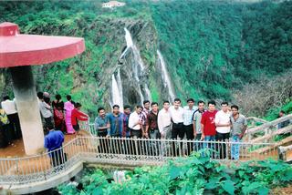
At last we have seen the board which says "Welcome to the world famous Jog Falls". It took us 7 hours to reach here. But where is the water falls, we still do not see it. No sound too. Hey the water falls is 1 km away from that board, so you don’t hear any buzz, or even could not see any thing because of the thick forest around. Soon after getting down we decided to have lunch and then have a look at the water falls. But we could not stop ourselves we rushed to the viewing spot to have glance at that magnificent scene. It was really amazing to see water falling from up to 829 feet tall. And the people down seem to be like ants crawling here and there.


Group photo at Jog Falls
This is another tall waterfall that runs amok during monsoon season, exceeding even Kaieteur Falls in Guyana in terms of height and volume. We've seen the falls reported to be up to 960 feet tall, however, the figure 829 feet is known to be more accurate because that height was derived by dropping a weighted line into the gorge. The photo below shows the falls in full flood.
Image 21


At last we have seen the board which says "Welcome to the world famous Jog Falls". It took us 7 hours to reach here. But where is the water falls, we still do not see it. No sound too. Hey the water falls is 1 km away from that board, so you don’t hear any buzz, or even could not see any thing because of the thick forest around. Soon after getting down we decided to have lunch and then have a look at the water falls. But we could not stop ourselves we rushed to the viewing spot to have glance at that magnificent scene. It was really amazing to see water falling from up to 829 feet tall. And the people down seem to be like ants crawling here and there.


Group photo at Jog Falls
This is another tall waterfall that runs amok during monsoon season, exceeding even Kaieteur Falls in Guyana in terms of height and volume. We've seen the falls reported to be up to 960 feet tall, however, the figure 829 feet is known to be more accurate because that height was derived by dropping a weighted line into the gorge. The photo below shows the falls in full flood.
Image 21


Jog Falls
The four segments of the falls are named, from left to right, the Raja, the Roarer, the Rocket, and the Rani (White Lady).
We came back had our lunch and then started the real exciting part of the trip, preparing to getting down.There is a lot of crowd there that day, which is very uncommon at Jog Falls. Later we learnt that the officials have released the water from the dam only previous days. Now we too decided to go down these hills to the bottoms where the water falls on the ground.


Before our Journey to the Bottom of Jog Falls
We started getting down the hill, it is very steep, and the path is not as good to move quickly. We should also take support of the trees and the rocks so that we won't fall down.
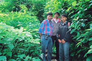

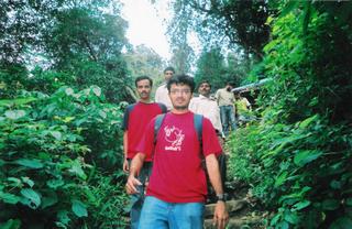

Steping down with care
It took me 25 minutes to get down that hill. Now occasionally showers of water droplets flew over us from the water falls. As the rocks under over feet are wet they are too slippery to stand still.


85% of our Journey to the Bottom of Jog Falls
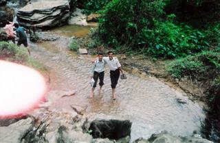
My friends couldn't balance over there bodies and started to slip and fall down. I was wearing my tracking shoes due to which I didn’t remove my shoes and never fell down even once but my friends removed there shoes and fell many times but thanks to GOD that nothing happened to any one of us. We walked slowly and slowly until we reached the lowest part.


The Ultimate Point
Now if you look up, you find as if water is directly coming from the sky, poured by some angel’s......


What a View
This is the lowest part we can reach ...


Dangerous Point
We remained there for sometime enjoyed the surroundings and at last started our journey back to the top, this was one of the toughfest part as getting down may be easy but coming back is always tough.
Now if you look up, you find as if water is directly coming from the sky, poured by some angel’s......


What a View
This is the lowest part we can reach ...


Dangerous Point
We remained there for sometime enjoyed the surroundings and at last started our journey back to the top, this was one of the toughfest part as getting down may be easy but coming back is always tough.
Terrable experience of Life


I remember many of friends where really unable to climb and where sitting now and then taking some amount of rest, but though I started late to climb back went non-stop by singing “kadam kadam badaye chal ... ”, and finally all of my friends reached the top.

Finally Succesfully reached the Top
And then we headed towards the other end of the Jog Falls and took a view from where exactly the water is coming and it was so force full that we can easily generate power with such high speed of water forcing down.


Jog Falls View from Otherside



I remember many of friends where really unable to climb and where sitting now and then taking some amount of rest, but though I started late to climb back went non-stop by singing “kadam kadam badaye chal ... ”, and finally all of my friends reached the top.

Finally Succesfully reached the Top
And then we headed towards the other end of the Jog Falls and took a view from where exactly the water is coming and it was so force full that we can easily generate power with such high speed of water forcing down.


Jog Falls View from Otherside


Came to know that associated with the waterfall is the nearby Linganamakki dam across the Sharavati river, and the hydro-electric power station that it serves. The power station has been operational since 1949, and is, at 1200 MW capacity, one of the largest hydro-electric stations in India and is a significant source of power for Karnataka. The power station was previously named Krishna Rajendra Hydro-Electric project, after the King of Mysore at the time. The name was later changed to Mahatma Gandhi Hydro-Electric Project. It was served by the Hirebhaskara dam until the 1960s. At this time, a dam across the Sharavati river was built just before the river jumps into the Jog Falls, and this dam has been used for power generation since then.
And finally backed to the hostel around 23:30.

Midnight at Our Hostel Gate




No comments:
Post a Comment